

 Sign-In
 Cart
Cart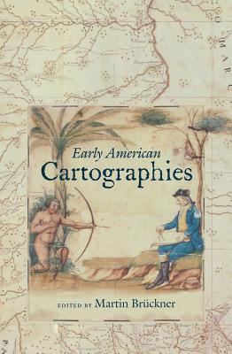
Early American Cartographies
Hardcover
Series: Published by the Omohundro Institute of Early American Histo
CartographyColonial Period (1600-1775)General World History
ISBN13: 9780807834695
Publisher: Omohundro Institute and Unc Press
Published: Dec 15 2011
Pages: 504
Weight: 1.80
Height: 1.60 Width: 6.40 Depth: 9.30
Language: English
Drawing from both current historical interpretations and new interdisciplinary perspectives, this collection provides diverse approaches to understanding the multilayered exchanges that went into creating cartographic knowledge in and about the Americas. In the introduction, editor Martin Bruckner provides a critical assessment of the concept of cartography and of the historiography of maps. The individual essays, then, range widely over space and place, from the imperial reach of Iberian and British cartography to indigenous conceptualizations, including dirty, ephemeral maps and star charts, to demonstrate that pre-nineteenth-century American cartography was at once a multiform and multicultural affair.
This volume not only highlights the collaborative genesis of cartographic knowledge about the early Americas; the essays also bring to light original archives and innovative methodologies for investigating spatial relations among peoples in the western hemisphere. Taken together, the authors reveal the roles of early American cartographies in shaping popular notions of national space, informing visual perception, animating literary imagination, and structuring the political history of Anglo- and Ibero-America.
The contributors are:
Martin Bruckner, University of Delaware
Michael J. Drexler, Bucknell University
Matthew H. Edney, University of Southern Maine
Jess Edwards, Manchester Metropolitan University
Junia Ferreira Furtado, Universidade Federal de Minas Gerais, Brazil
William Gustav Gartner, University of Wisconsin-Madison
Gavin Hollis, Hunter College of the City University of New York
Scott Lehman, independent scholar
Ken MacMillan, University of Calgary
Barbara E. Mundy, Fordham University
Andrew Newman, Stony Brook University
Ricardo Padron, University of Virginia
Judith Ridner, Mississippi State University
Also from
Brückner, Martin
The Geographic Revolution in Early America: Maps, Literacy, and National Identity
Brückner, Martin
Paperback
Also in
Cartography
The Lost Subways of North America: A Cartographic Guide to the Past, Present, and What Might Have Been
Berman, Jake
Hardcover
Map Art Lab: 52 Exciting Art Explorations in Mapmaking, Imagination, and Travel
Berry, Jill K.
McNeilly, Linden
Paperback
North American Maps for Curious Minds: 100 New Ways to See the Continent
Cizek, Victor
Bucklan, Matthew
Hardcover
The ESRI Guide to GIS Analysis, Volume 1: Geographic Patterns and Relationships
Mitchell, Andy
Paperback
Mapping the Adirondacks: Colvin, Blake, and the First True Survey of the Great Adirondack Wilderness
Hogan, Thatcher
Hardcover
History of Cities in Maps: The Ultimate Visual Exploration of Human Civilisation Through 70 Captivating Historical Maps
Parker, Philip
Collins Books
Hardcover
Mapping America's National Parks: Preserving Our Natural and Cultural Treasures
Us National Park Service
Paperback
The Red Atlas: How the Soviet Union Secretly Mapped the World
Davies, John
Kent, Alexander J.
Hardcover
Elements of Photogrammetry with Application in Gis, Fourth Edition
DeWitt, Bon A.
Wolf, Paul R.
Wilkinson, Benjamin E.
Hardcover
Imagery and GIS: Best Practices for Extracting Information from Imagery
Green, Kass
Congalton, Russell G.
Tukman, Mark
Paperback
Counterpoints: A San Francisco Bay Area Atlas of Displacement & Resistance
Project, Anti-Eviction Mapping
Paperback
Terra Forma: A Book of Speculative Maps
Arenes, Alexandra
Gregoire, Axelle
Ait-Touati, Frederique
Hardcover
An Atlas of Countries That Don't Exist: A Compendium of Fifty Unrecognized and Largely Unnoticed States
Middleton, Nick
Hardcover
The Fourth Part of the World: An Astonishing Epic of Global Discovery, Imperial Ambition, and the Birth of America
Lester, Toby
Paperback
L'Amérique Méridionale: The Map That Shaped Brazil in the 18th Century
Ferreira Furtado, Junia
Hardcover
Texas Takes Shape: A History in Maps from the General Land Office
Harkins, James
Stauffer, Brian A.
Lambert, Mark
Hardcover
Whimsical Mandala Adult coloring books: Art Design for Relaxation and Mindfulness
Tiny Cactus Publishing
Paperback
How Maps Change Things: A Conversation about the Maps We Choose and the World We Want
Kaiser, Ward L.
Paperback
Collaborative Cities: Mapping Solutions to Wicked Problems
Goldsmith, Stephen
Markin Coleman, Kate
Paperback
I love Dachshund Coloring Books for Adults: Dachshund and Friends Dog Animal Stress-relief Coloring Book For Grown-ups
Balloon Publishing
Paperback
Counterpoints: A San Francisco Bay Area Atlas of Displacement & Resistance
Project, Anti-Eviction Mapping
Hardcover
A Moving Border: Alpine Cartographies of Climate Change
Pasqual, Elisa
Bagnato, Andrea
Ferrari, Marco
Paperback
The Indies of the Setting Sun: How Early Modern Spain Mapped the Far East as the Transpacific West
Padrón, Ricardo
Paperback
To Master the Boundless Sea: The U.S. Navy, the Marine Environment, and the Cartography of Empire
Smith, Jason W.
Paperback
FM 1-02.2 Military Symbols: With Special AI-powered Essay on Graphic Design & Military Symbology
Department of the Army
Hardcover
The Naming of America: Martin Waldseemüller's 1507 World Map and the Cosmographiae Introductio
Hessler, John W.
Hardcover
Mapping the Transmississippi West 1540-1861: [Volumes One through Three Bound in One]
Wheat, Carl I.
Hardcover
Map Use: Reading, Analysis, Interpretation
Buckley, Aileen R.
Muehrcke, Phillip C.
Kimerling, A. Jon
Hardcover
Wish You Were Here: Guidebooks, Viewbooks, Photobooks, and Maps of New York City 1807-1940
Tomasko, Mark D.
Paperback
The Mapping of Power in Renaissance Italy: Painted Cartographic Cycles in Social and Intellectual Context
Rosen, Mark
Hardcover
Atlas of Geographical Wonders: From Mountaintops to Riverbeds
Palsky, Gilles
Besse, Jean-Marc
Bailly, Jean-Christophe
Hardcover
Elements Of Map Projection: With Applications To Map And Chart Construction
Deetz, Charles Henry
Hardcover
SnowFlakes Coloring Book Dark Edition Vol.2: Swear Word, Christmas, Flowers and Mandala Design
Snowflakes Team
Swear Word Coloring Book Dark
Paperback
How do I do that in Spatial SQL (Manifold 8): illustrating classic GIS tasks
Lembo Jr, Arthur J.
Paperback
Adjustment Models in 3D Geomatics and Computational Geophysics: With MATLAB Examples Volume 4
Alsadik, Bashar
Paperback
Facies Analysis and Interpretation in Southeastern Nigeria's Inland Basins
Dim, Chidozie Izuchukwu Princeton
Paperback
Graph Paper: 120 pages / 5 x 5 Grid Paper 8.5 x 11 Inch / 21.59 x 27.94 cm
Designs, Academic Essential
Paperback
Cartography and the Political Imagination: Mapping Community in Colonial Kenya
MacArthur, Julie
Hardcover
Cartography and the Political Imagination: Mapping Community in Colonial Kenya
MacArthur, Julie
Paperback
Graph Paper: 120 pages / 5 x 5 Grid Paper 8.5 x 11 Inch / 21.59 x 27.94 cm
Designs, Academic Essential
Paperback
Latitude and Departure Calculations of Land Made Easy and Self-proving
Raudabaugh, Israel Franklin 1844-
Paperback
Elements Of Map Projection: With Applications To Map And Chart Construction
Deetz, Charles Henry
Paperback
Surveying and Mapping Simplified; a Book of Suggestions for Those Who Adventure With Maps
Sparrow, Kenneth Christopher 1910-
Paperback
Map Projections: A Working Manual (U.S. Geological Survey Professional Paper 1395)
Snyder, John P.
Paperback
Map Reading and Navigation: The Official U.S. Army Field Manual, FM 3.25-26
U. S. Army Department
Paperback
Mapping Yellowstone: A History of the Mapping of Yellowstone National Park
Blevins, Bruce H.
Paperback
Matanzas desde los mapas y planos
Cotarelo Crego, Ramón
Orihuela León, Johanset
Viera Muñoz, Ricardo
Paperback
Spatial Database Systems: Design, Implementation and Project Management
Hall, G. Brent
Yeung, Albert K. W.
Hardcover
Cartographies of Tsardom: The Land and Its Meanings in Seventeenth-Century Russia
Kivelson, Valerie A.
Paperback
Graph Paper: 120 pages / 5 x 5 Grid Paper 8.5 x 11 Inch / 21.59 x 27.94 cm
Designs, Academic Essential
Paperback
Traveling from New Spain to Mexico: Mapping Practices of Nineteenth-Century Mexico
Carrera, Magali M.
Paperback
Mediæval Geography. An Essay in Illustration of the Hereford Mappa Mundi
Havergal, Francis T. 1829-1890
Phillott, Henry Wright
Bevan, William Latham
Hardcover
Stadia Surveying: the Theory of Stadia Measurements, Accompanied by Tables of Horizontal Distances and Differences of Level for the Redu
Winslow, Arthur 1860-
Hardcover