

 Sign-In
 Cart
Cart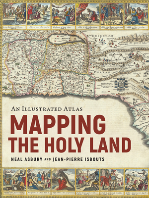
Mapping the Holy Land: An Illustrated Atlas
Hardcover
AtlasesIsrael & Palestine History
Publisher Price: $40.00
ISBN13: 9781954641341
Publisher: Apollo Publishers
Published: Oct 1 2024
Pages: 304
Weight: 2.65
Height: 1.00 Width: 7.70 Depth: 10.10
Language: English
A stunning journey through the Holy Land, as told by the rare maps and prints that have long inspired Jewish, Christian, and Muslim pilgrimages.
From the earliest days of the Roman Empire to the current war between Israel and Hamas, mapping the Holy Land has been a never-ending source of high aspirations and bitter conflict. Sacred to Jews, Christians, and Muslims, the Holy Land has always inspired Christians to walk in the footsteps of the Bible, to imagine the route of the Exodus, or discover the places of Jesus' ministry. Muslims, too, longed to see the geographical contours of the ummah, the greater Muslim community, while Jews remembered the days when Jerusalem was the destination for three holy festivals. In response, cartographers from Late Antiquity to the Modern Age drew their inspiration from Jewish, Christian, and Muslim pilgrimages to depict, with growing confidence, the exotic locations of the Holy Land.
Mapping the Holy Land is the first book to tell the thrilling story of these travels and the incredible prints and maps they spawned, up to the wars of the twentieth and twenty-first centuries. Illustrated with rare, hand-colored maps and engravings throughout and riveting scene-setting history, this remarkable volume from rare maps collector Neal Asbury, CEO of The Legacy Companies and host of Neal Asbury's Made in America, and National Geographic best-selling author Jean-Pierre Isbouts, coauthors of Mapping America, shows how the faithful overcame impossible odds to reach the Holy Land, and dives deep into the historical understanding of these elusive lands from Roman times up to the modern Israeli-Arab conflict.
Also from
Asbury, Neal
Mapping America: The Incredible Story and Stunning Hand-Colored Maps and Engravings That Created the United States
Isbouts, Jean-Pierre
Asbury, Neal
Hardcover
Also in
Israel & Palestine History
The Hundred Years' War on Palestine: A History of Settler Colonialism and Resistance, 1917-2017
Khalidi, Rashid
Paperback
The Shortest History of Israel and Palestine: From Zionism to Intifadas and the Struggle for Peace
Scott-Baumann, Michael
Paperback
Black Saturday: An Unfiltered Account of the October 7th Attack on Israel and the War in Gaza
Yingst, Trey
Hardcover
The Gates of Gaza: A Story of Betrayal, Survival, and Hope in Israel's Borderlands
Tibon, Amir
Hardcover
One Jewish State: The Last, Best Hope to Resolve the Israeli-Palestinian Conflict with a Foreword by Mike Pompeo
Friedman, David
Hardcover
Ghosts of a Holy War: The 1929 Massacre in Palestine That Ignited the Arab-Israeli Conflict
Schwartz, Yardena
Hardcover
Except for Palestine: The Limits of Progressive Politics
Plitnick, Mitchell
Hill, Marc Lamont
Paperback
The Hundred Years' War on Palestine: A History of Settler Colonialism and Resistance, 1917-2017
Khalidi, Rashid
Hardcover
A Genocide Foretold: Reporting on Survival and Resistance in Occupied Palestine
Hedges, Chris
Paperback
The Wall Between: What Jews and Palestinians Don't Want to Know about Each Other
Wilkinson, Jeffrey
Khouri, Raja
Paperback
The Holocaust Industry: Reflections on the Exploitation of Jewish Suffering
Finkelstein, Norman G.
Paperback
Mossad: The Greatest Missions of the Israeli Secret Service
Bar-Zohar, Michael
Mishal, Nissim
Paperback
The Genius of Israel: The Surprising Resilience of a Divided Nation in a Turbulent World
Singer, Saul
Senor, Dan
Hardcover
What's Next? Israel-Gaza War: Connecting Today's Headlines to Tomorrow's Prophetic Events
Evans, Jimmy
Hitchcock, Mark
Paperback
The First Advent in Palestine: Reversals, Resistance, and the Ongoing Complexity of Hope
Nikondeha, Kelley
Hardcover
Colonizing Palestine: The Zionist Left and the Making of the Palestinian Nakba
Sabbagh-Khoury, Areej
Paperback
The Holy and the Broken: A Cry for Israeli-Palestinian Peace from a Land That Must Be Shared
Flescher, Ittay
Paperback
Can We Talk about Israel?: A Guide for the Curious, Confused, and Conflicted
Sokatch, Daniel
Paperback
Niv, Chronological Study Bible, Hardcover, Comfort Print: Holy Bible, New International Version
Thomas Nelson
Hardcover
Wake Up and Reclaim Your Humanity: Essays on the Tragedy of Israel-Palestine
Forer, Richard
Paperback
Beyond Chutzpah: On the Misuse of Anti-Semitism and the Abuse of History
Finkelstein, Norman
Paperback
History of the Jews: A Captivating Guide to Jewish History, Starting from the Ancient Israelites through Roman Rule to World War 2
History, Captivating
Hardcover
The Victorians and the Holy Land: Adventurers, Tourists, and Archaeologists in the Lands of the Bible
Chapman, Allan
Paperback
To Stand with Palestine: Transnational Resistance and Political Evolution in the United States
Dana, Karam
Paperback
Attack on the Liberty: The Untold Story of Israel's Deadly 1967 Assault on a U.S. Spy Ship
Scott, James M.
Paperback
I Shall Not Hate: A Gaza Doctor's Journey on the Road to Peace and Human Dignity
Abuelaish, Izzeldin
Paperback
BDS: Boycott, Divestment, Sanctions: The Global Struggle for Palestinian Rights
Barghouti, Omar
Paperback
Environmental Warfare in Gaza: Colonial Violence and New Landscapes of Resistance
Molavi, Shourideh C.
Paperback
Knowing Too Much: Why the American Jewish Romance with Israel Is Coming to an End
Finkelstein, Norman
Paperback
The Unspoken Alliance: Israel's Secret Relationship with Apartheid South Africa
Polakow-Suransky, Sasha
Paperback
Nkjv, Chronological Study Bible, Hardcover, Comfort Print: Holy Bible, New King James Version (Large Print Edition)
Thomas Nelson
Hardcover
Treacherous Alliance: The Secret Dealings of Israel, Iran, and the U.S. (Large Print Edition)
Parsi, Trita
Paperback
The Abraham Accords: The Gulf States, Israel, and the Limits of Normalization
Fakhro, Elham
Hardcover
Except for Palestine: The Limits of Progressive Politics
Hill, Marc Lamont
Plitnick, Mitchell
Hardcover
Coca-Cola, Black Panthers, and Phantom Jets: Israel in the American Orbit, 1967-1973
Frankel, Oz
Paperback
Another Zionism, Another Judaism: The Unrequited Love of Rabbi Marcus Ehrenpreis
Rosenberg, Göran
Hardcover
The Only Language They Understand: Forcing Compromise in Israel and Palestine
Thrall, Nathan
Paperback
The Arc of a Covenant: The United States, Israel, and the Fate of the Jewish People
Mead, Walter Russell
Paperback
Decolonizing Israel, Liberating Palestine: Zionism, Settler Colonialism, and the Case for One Democratic State
Halper, Jeff
Paperback
From Zion's Dawn: A Condensed History of Modern Israel from 1880 to 2023
Hetherington, Andrew D.
Paperback