

 Sign-In
 Cart
Cart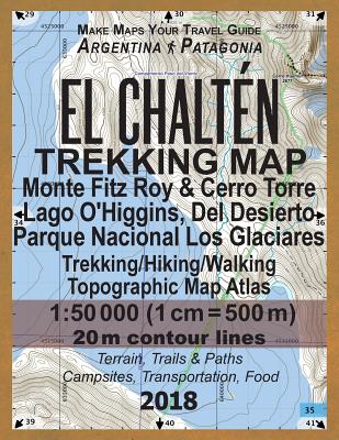
El Chalten Trekking Map Monte Fitz Roy & Cerro Torre Lago O'Higgins, Del Desierto Parque Nacional Los Glaciares Trekking/Hiking/Walking Topographic Ma
Paperback
Series: Travel Guide Hiking Maps for Patagonia Argentina
ISBN13: 9781983461637
Publisher: Createspace
Published: Jan 1 2018
Pages: 44
Weight: 0.37
Height: 0.11 Width: 8.50 Depth: 11.00
Language: English
Covers all the trails in the hiking area of El Chaltén: the Fitz Roy mountain, Cerro Torre, Huemul trail, Piedra Del Fraile, Poincenot, De Agostini, trail to Paso Marconi over the Patagonian Southern Ice Field, and others. Also covers Lago del Desierto and significant part of Lago O'Higgins and the glaciers that flow into it on the Chilean side.
The details included in the topographic maps of this atlas were specifically selected to be useful for trekkers, hikers and walkers of all interests, and make it easy to plan and enjoy both short excursions and hikes as well as long multi-day adventures along the main marked routes and/or adjacent trails and paths, which are also shown on the maps.
With this ultralight atlas you will always have a detailed, reliable, information-rich, battery-independent, shatter-proof map for your adventure.
Also in
South America
My (Half) Latinx Kitchen: Half Recipes, Half Stories, All Latin American
Wright-Ruiz, Kiera
Hardcover
Mother of God: An Extraordinary Journey Into the Uncharted Tributaries of the Western Amazon
Rosolie, Paul
Paperback
The Everything Learning Brazilian Portuguese Book, 2nd Edition: Speak, Write, and Understand Basic Brazilian Portuguese in No Time
Ferreira, Fernanda
Paperback
The Rough Guide to Ecuador and the Galapagos: Travel Guide with eBook
Humphreys, Sara
Guides, Rough
Paperback
Moon Ecuador & the Galápagos Islands: Outdoor Adventure, Indigenous Culture, Sustainable Travel
Moon Travel Guides
Pitts, Bethany
Paperback
Lonely Planet Chile & Rapa Nui (Easter Island)
Harrell, Ashley
Johanson, Mark
Albiston, Isabel
Paperback
Fodor's Essential Argentina: With the Wine Country, Uruguay & Chilean Patagonia
Fodor's Travel Guides
Paperback
A Most Remarkable Creature: The Hidden Life of the World's Smartest Birds of Prey
Meiburg, Jonathan
Paperback
Insight Guides Chile and Rapa Nui (Easter Island): Travel Guide with eBook
Insight Guides
Jasper, Heather
Paperback
Moon Patagonia: With National Parks in Argentina & Chile: Fjords, Glaciers, Road Trips
Moon Travel Guides
Bernhardson, Wayne
Paperback
Fodor's Essential Argentina: With the Wine Country, Uruguay & Chilean Patagonia
Fodor's Travel Guides
Paperback
Costa Rica - Culture Smart!: The Essential Guide to Customs & Culture
Koutnik, Jane
Culture Smart!
Paperback
Life and Death in the Andes: On the Trail of Bandits, Heroes, and Revolutionaries
MacQuarrie, Kim
Paperback
Brazil - Culture Smart!: The Essential Guide to Customs & Culture
Branco, Sandra
Culture Smart!
Paperback
Wildlife Conservation Society Birds of Brazil: The Atlantic Forest of Southeast Brazil, Including São Paulo and Rio de Janeiro
Tudor, Guy
Ridgely, Robert S.
Gwynne, John A.
Paperback
Argentina - Culture Smart!: The Essential Guide to Customs & Culture
Hamwee, Robert
Godward, Mary
Culture Smart!
Paperback
Brazil, Amazon and Pantanal (Traveller's Wildlife Guides): Traveller's Wildlife Guide
Beletsky, Les
Pearson, David L.
Paperback
Portuguese for Beginners: A Comprehensive Guide to Learning the Portuguese Language Fast
Abreu, Cezar
Hardcover
Moon Chile: With Patagonia & Rapa Nui (Easter Island): Volcanoes & Glaciers, Vineyards & Beaches, Wildlife-Watching
Moon Travel Guides
Dyson, Steph
Paperback
Travel to Brazil: The Cookbook - Recipes from Throughout the Country, and the Stories of the People Behind Them
de Oliveira, Polyana
Hardcover
Birds of South America: Non-Passerines: Rheas to Woodpeckers
Rumboll, Maurice
Erize, Francisco
Paperback
Traeger Grill & Smoker Cookbook: The Complete Wood Pellet Smoker and Grill Cookbook
Blardn, Jarden
Hardcover
Portuguese Conversation Made Natural: Engaging Dialogues to Learn Portuguese
Guru, Language
Paperback
Antarctica: Shocking Secrets: Extraordinary Discoveries Of Hidden Mysteries
Shepherd, Samuel
Paperback
Colombia - Culture Smart!: The Essential Guide to Customs & Culture
Cathey, Kate
Culture Smart!
Paperback
Ruthless River: Love and Survival by Raft on the Amazon's Relentless Madre de Dios
Fitzgerald, Holly
Paperback
PATAGONIA, Torres del Paine National Park: Smart Travel Guide for Nature Lovers, Hikers, Trekkers, Photographers
Senkov, Oleg
Paperback
Peru - Culture Smart!: The Essential Guide to Customs & Culture
Porturas, Julia
Culture Smart!
Forrest, John
Paperback
Ecuador - Culture Smart!: The Essential Guide to Customs & Culture
Culture Smart!
Maddicks, Russell
Paperback
Easy Portuguese Phrase Book: Over 1500 Common Phrases For Everyday Use And Travel
Lingo Mastery
Paperback
Peru Travel Guide 2024, 2025, and Beyond: A Guidebook to this Beautiful Country
Jacobs, Ryan
Paperback
Buenos Aires Travel guide 2023-2024: Explore Buenos Aires to get to the heart of Argentina
Andrews, Sandra
Paperback
The Galapagos Islands and Ecuador: Your Essential Handbook for Exploring Darwin's Enchanted Islands, 3rd Edition
Stephenson, Marylee
Paperback
Guatemala - Culture Smart!: The Essential Guide to Customs & Culture
Culture Smart!
Maddicks, Russell
Paperback
Southward Bound: The adventure and wonder of road trips through Latin America
Miller, David
Paperback
How to Walk a Puma: And Other Things I Learned While Stumbling Through South America
Allison, Peter
Paperback
Colombia: A Rosen-Cooney Travel Story-No Passports Required: Bogota, the Coffee Zone, Cartagena, and Tayrona National Park
Rosen, Alexandra
Paperback
The Black History Truth - Argentina: No Hay Gente Negroes Aqui (There Are No Black People Here)
Gayle, Pamela
Paperback
Chile - Culture Smart!: The Essential Guide to Customs & Culture
Culture Smart!
Perrone, Caterina
Paperback
Narcissistic Mothers: The truth about the problem with being the daughter of a narcissistic mother, and how to fix it. A guide for healing a
J. Covert, Dr Theresa
Paperback
Buenos Aires Travel Guide 2023 And Beyond: Discover the Best of Argentina's Vibrant Capital
Felipe, Joaquín
Paperback
Bolivia Travel guide 2023-2024: Exploring Bolivia is the ideal travel companion for South America
Andrews, Sandra
Paperback
No One Said It Would Be Easy: A youthful folly across the Americas on old bikes
Molloy, Des
Paperback